North America Classic Map, Laminated
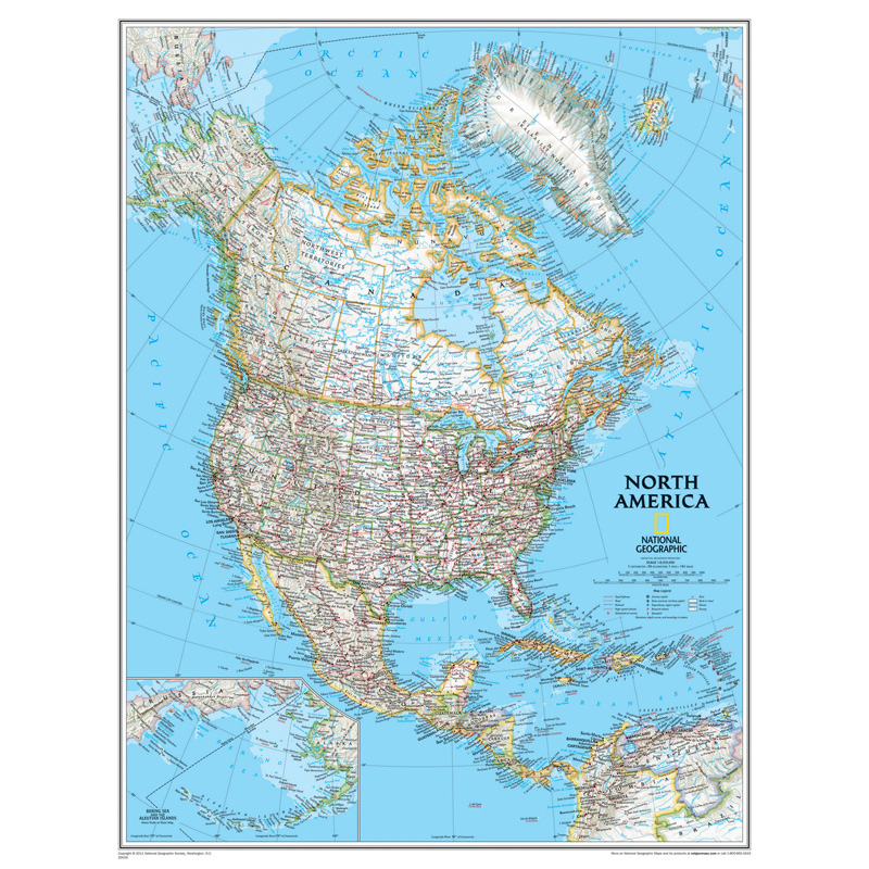
Embark on an immersive exploration of North America with National Geographic's North America Classic Map, now available in a durable laminated format for enduring reliability. From the icy expanses of the Arctic Sea to the tropical shores of the Caribbean, this map showcases trademark National Geographic detail and accuracy, featuring a bright color palette with blue oceans and stunning shaded relief that has been a hallmark of National Geographic wall maps for over 75 years. Political boundaries are clearly defined, providing essential geographic context, while thousands of place names, airports, major roadways, and other geographical features are easy to read, ensuring seamless navigation and exploration.
In addition to comprehensive coverage of Canada, the United States, Mexico, and Central America, this map includes Iceland, Greenland, the island nations of the Caribbean, Venezuela, and most of Colombia, offering a holistic view of the region's diverse territories. An inset map highlights the Aleutian Islands off the coast of Alaska, providing additional detail and context. Encapsulated in heavy-duty 1.6 mil laminate, this map is resistant to changes in humidity, ensuring long-lasting durability. Whether you're a student, traveler, or geography enthusiast, the National Geographic North America Classic Map, laminated for reliability, is an indispensable tool for exploring the wonders of North America.
Social Studies : Maps & Map Skills
National Geographic Maps - NGMRE00620148
Quantity Available in warehouse in Semmes, Alabama for Web Orders: 19
(This item is most likely NOT AVAILABLE in our store in St. Louis. To double check or have us find something similar, please call 314-843-2227 with the sku 'NGMRE00620148' and let us know how we can help)
Package Dimensions: Length 25.0000" Width 2.0000" Height 2.0000"
Grade: Grade 9+
Age: 14+ years
Most Popular

Metal Edged Yardstick Ruler, Inches and 1/8 Yard Measurements, Natural Wood, 36 Inches
Advantus - CHL77565
$4.19


May News
.png)
.png)
